Table of Contents
(?)
Site Page Counts
Public: 229
Restricted: 51
- Overview
- NY Kletsker Cemetery Data
- Searching for KIRZNER
- UKR 1946
- Benari Memoir
- Kletsk to Zaostrovechye
- Recreating Kletsk
- Pshepyurko Interview
- Sonia's Places
- Gelfand Memoir
- Yizkor Book
- Contributors Only
Site Page Counts
Public: 229
Restricted: 51
United Kletzker Relief Journal 1946
Photos: Town Views
These photos depict key features of the town of Kletsk.
 |
| English caption TBD [original page 58] |
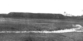
| Webmaster's Notes: See the same photo in the Kletsk Yizkor Book. The water in the foreground is the Lan' River, a rather sluggish stream that flowed approximately north to south to the west of Kletsk. (The entire area was flat and swampy.) The rise at center is the remains of an ancient fortress. It was called Der Val ("the wall") by the Kletsk Jewish population. |
 |
| English caption TBD [original page 81] |
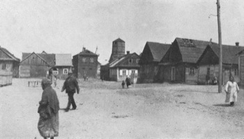
| Webmaster's Notes: See the same photo with a different caption in the Kletsk Yizkor Book. A view looking north-east. The water tower visible at center rear was located in the south west portion of the Kletsk main square. The nature of this open area in the foreground is unknown; possibly simply a common area behind the houses that lined the streets of the town. |
 |
| English caption TBD [original page 56] |
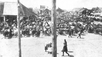
| Webmaster's Notes: See the same photo in the Kletsk Yizkor Book. A view of Kletsk's main square on a market day, looking approximately south-west across the western portion of the main square. Just visible at center-rear is the large roof of Kletsk's largest synagogue, the Kalte Shul. |
 |
| English caption TBD [original page 55] |
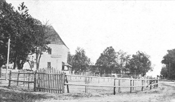
| Webmaster's Notes: See the same photo in the Kletsk Yizkor Book. |
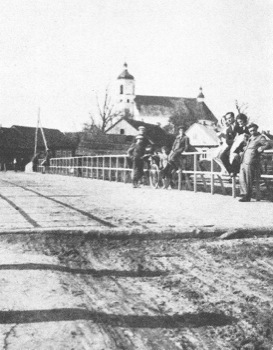 |
| English caption TBD [original page 52] |
| Webmaster's Notes: A rare photo of the Lan River bridge, looking east toward the Jewish community of Kletsk. The photo was reversed as printed: this view has been adjusted so that the Catholic church in the background correctly appears to the right. The church survived World War II, but is currently in ruins. |